
Tutorials
Mercator Guide
How to download Mercator Ocean current data directly from Copernicus Marine, without using the built-in Downloader.
This is currently the only way to get Mercator data into STFM. Unlike HYCOM, GFS, and ERA5, the Downloader doesn't fetch Mercator currents, and the Converter doesn't yet have a dedicated card for them that support is being worked on. If HYCOM currents are enough for your project, the Downloader Guide is a faster path.
Overview
Mercator Ocean's global current model is distributed through the Copernicus Marine Service, product GLOBAL_ANALYSISFORECAST_PHY_001_024 a 1/12° resolution ocean physics analysis and forecast, including eastward and northward current velocity.
Creating an account
- Go to data.marine.copernicus.eu and click Register. Fill in name, email, country, and organisation type.
- Confirm your email and log in.
This account is separate from the one used for ERA5. Copernicus Marine and the Climate Data Store (CDS) both carry the "Copernicus" name but run independent account systems an account on one doesn't work on the other. If you're setting up both, expect to register twice.
Step by step
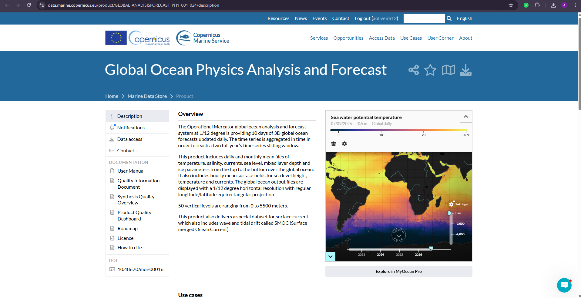
1. Find the product
Search for Global Ocean Physics Analysis and Forecast (product ID GLOBAL_ANALYSISFORECAST_PHY_001_024). Confirmed specs from the product page: 1/12° resolution (0.083° × 0.083°), 50 depth levels from 0 to 5500 m, and Hourly / Daily / Monthly time frequency options.
2. Select your variables
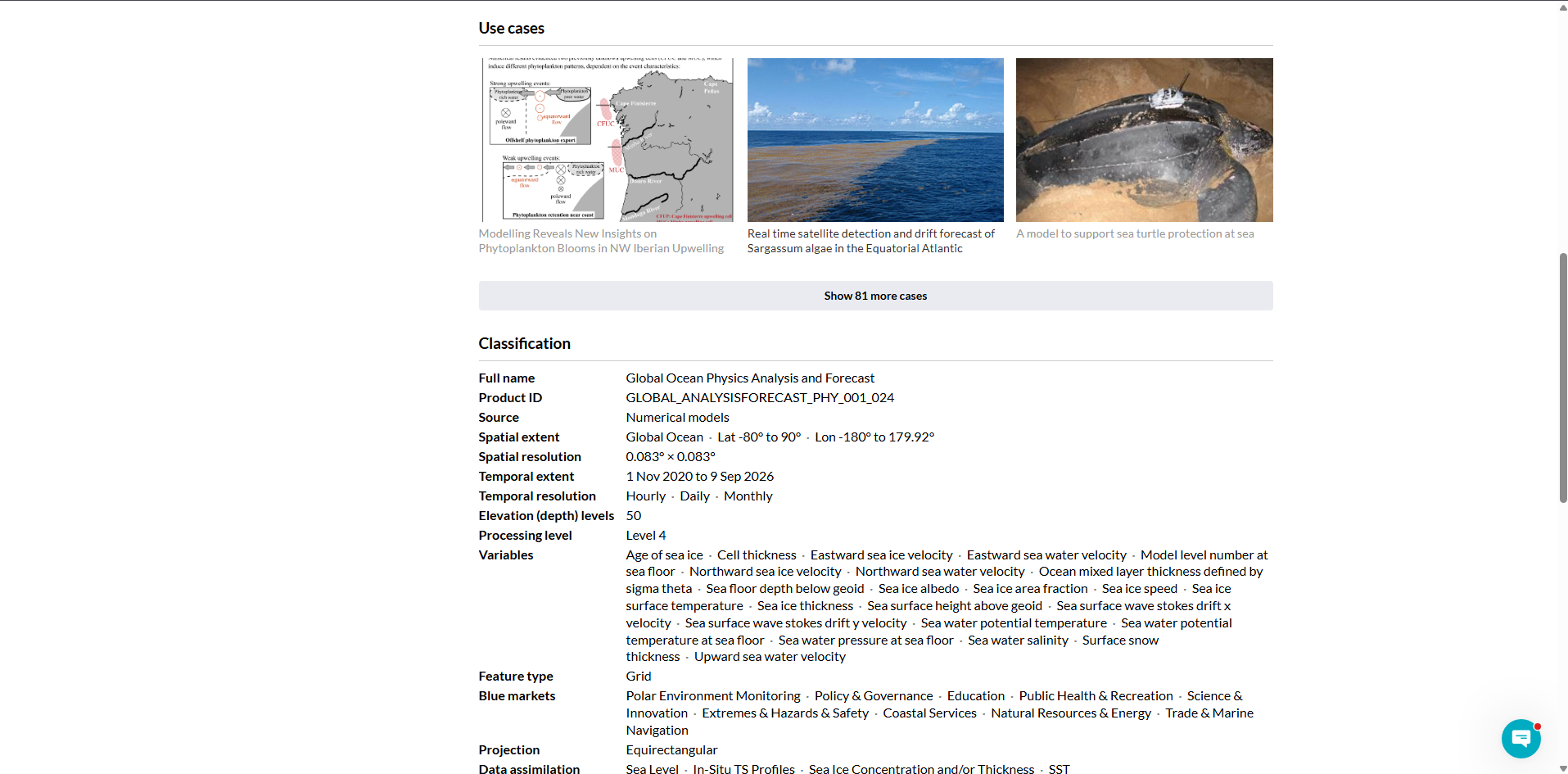
The product's full variable list (visible under the Classification section) confirms the exact names to look for:
- Eastward sea water velocity
- Northward sea water velocity
Also select the depth levels (surface only for 2D simulations, the full range for 3D) and a time frequency matching your simulation's timestep.
3. Open Data access and pick the right dataset row
Direct link: data.marine.copernicus.eu/.../services opens the Data access page directly (log in first). Instead of one generic form, this opens a table listing every variant of the product different variables and time frequencies, each as its own row with its own Form / Browse / WMTS links.
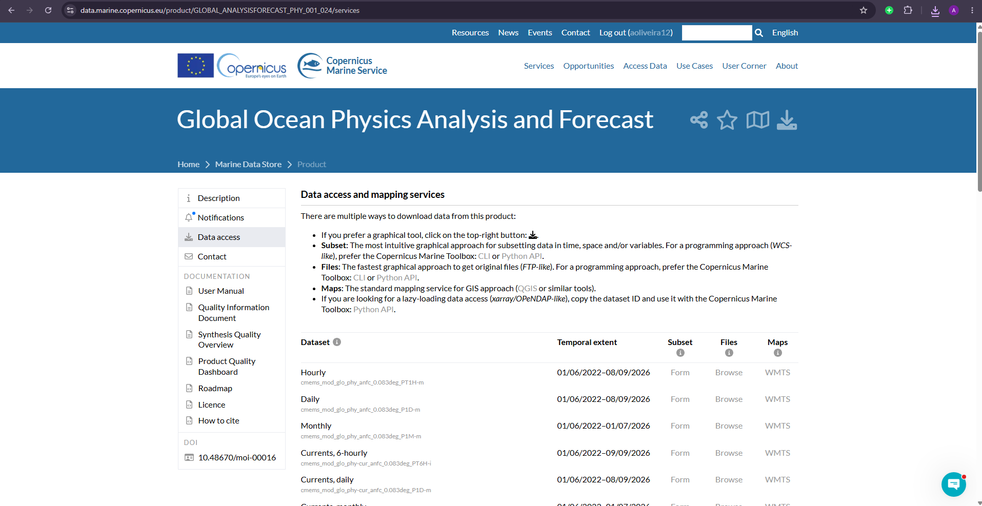
For a single STFM project, use the Subset column's Form link described on the page as "the most intuitive graphical approach for subsetting data in time, space and/or variables."
Two valid dataset choices, pick based on your setup:
- Currents, 6-hourly / daily / monthly (
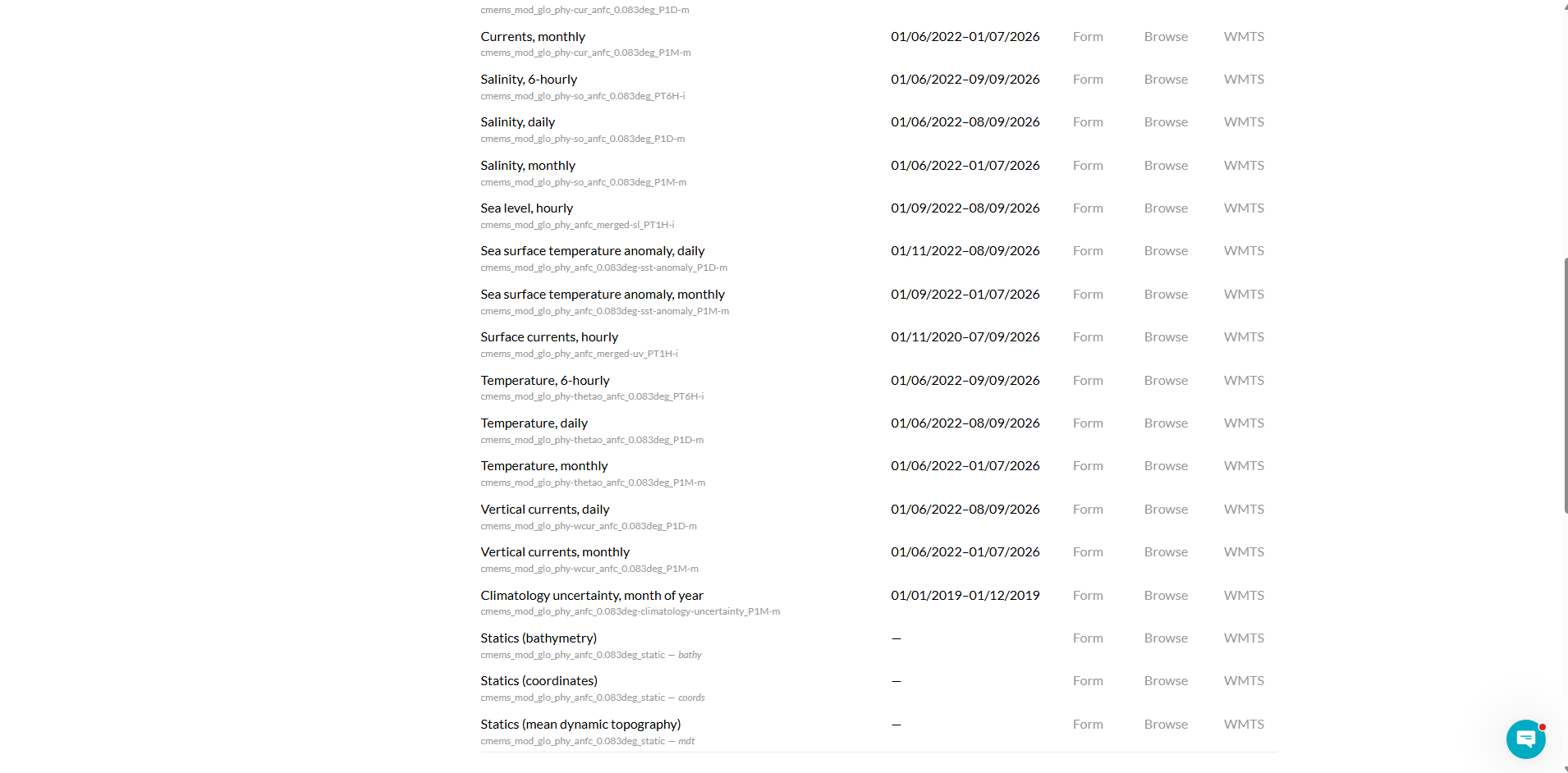
cmems_mod_glo_phy-cur_anfc_0.083deg_*) the standard multi-depth ocean current output. Use this if you're also loading wave data into STFM's Waves panel separately, so wave-driven drift isn't calculated twice. - Surface currents, hourly (
cmems_mod_glo_phy_anfc_merged-uv_PT1H-i) the "SMOC" (Surface merged Ocean Current) product, which already blends in wave and tidal drift. Use this if you're not loading a separate wave source, so drift is still accounted for.
The form below is identical either way only the Dataset dropdown and file size change.
4. Fill in the subset form
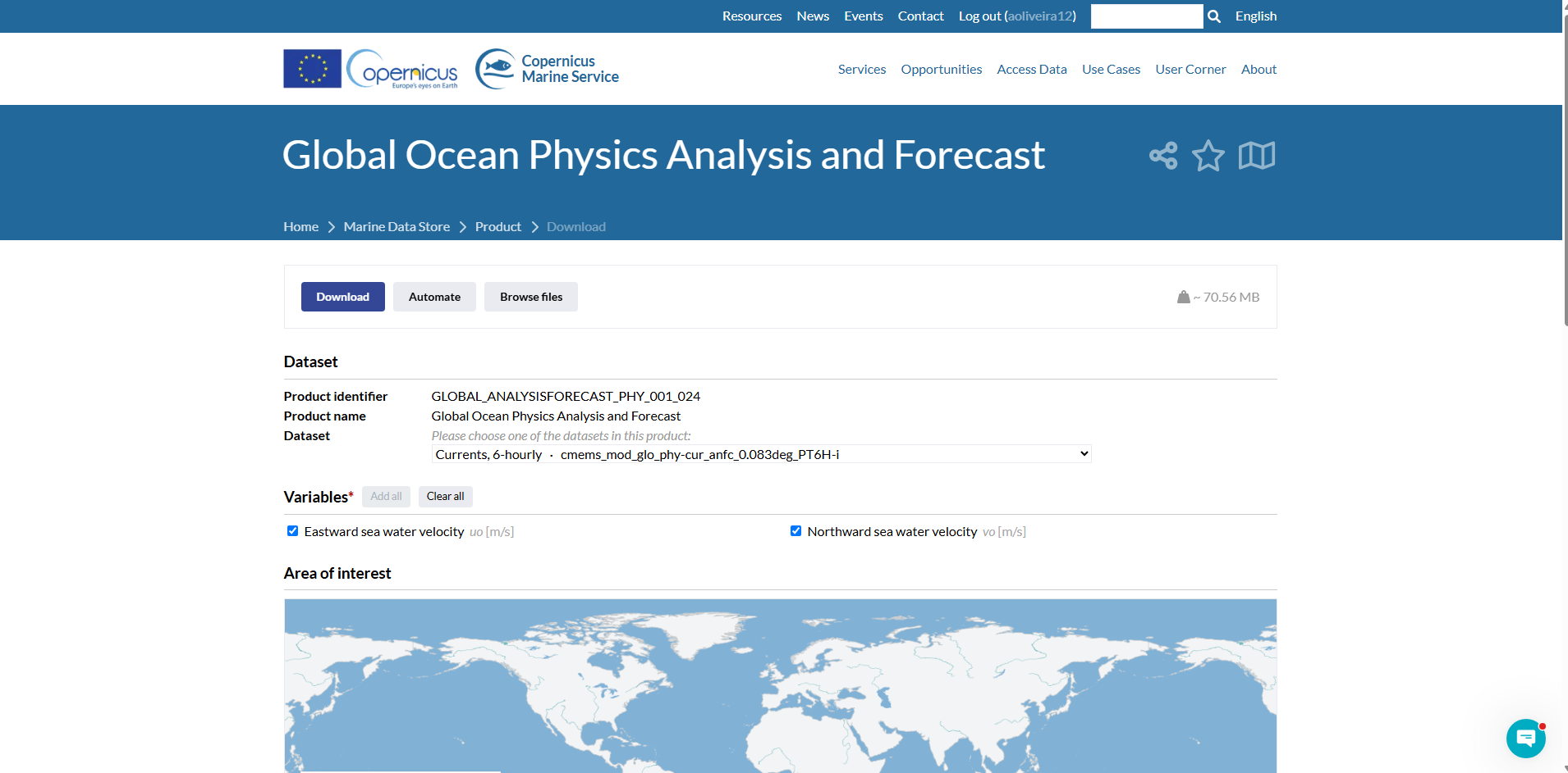
Clicking Form opens the request page, showing the file size estimate (~70.56 MB for the default selection) and a Dataset dropdown confirming which row you picked you can switch it here without going back.
- Variables: Eastward sea water velocity (
uo, m/s) and Northward sea water velocity (vo, m/s) are checked by default leave both checked. - Area of interest: use Draw on map, or type exact bounds into the N / W / E / S fields, matching your STFM grid area.
- Date range: defaults to just today's date for both From and To change these to cover your actual simulation period (the page shows the full available range above the fields as a reference, e.g. 01/06/2022 to the present).
- Depth range: defaults to the shallowest available layer (around 0.49 m) for both From and To for 2D simulations this default is already correct (surface only); for 3D, widen it toward the deeper end of the available range shown above the fields.
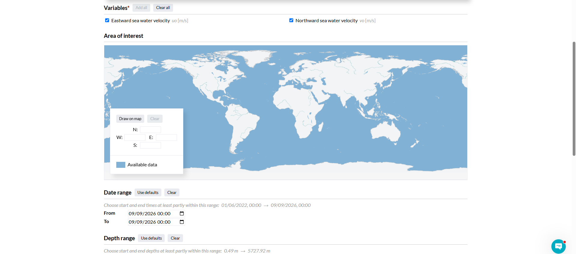
Once everything is set, click Download (or Automate for a scriptable request, useful for repeating the same area across several days).
5. Download and save
Once your request is submitted, save the resulting file into your project's RAW_DATA/ folder.
Next steps
Mercator currents don't have a dedicated Converter card yet see the note in the Converter Guide for the current status.
More Guides
Continue with ERA5 winds
Currents alone aren't enough STFM always requires wind data too.